Snowdonia in winter
Learning about Snowdonia is a real numbers game. Here’s a selection of our favourite Snowdonia stats, facts and figures.
Snowdonia is a fascinating place. It’s easy to lose yourself in the geography, the history and the size of the region, and before you know it you’ll find yourself buried in statistics.
With this in mind, here are some of the most interesting Snowdonia facts and figures, in bite-sized chunks for easy digestion.
2,548 square kilometres
The Snowdonia Mountains and Coast region spans a large area of North Wales, from Corris in the south to Conwy in the north. Most of this area is within the county of Gwynedd. The Snowdonia Mountains and Coast region covers 2,548 square kilometres and includes areas which aren’t part of the National Park.
The Snowdonia National Park sits within the Snowdonia Mountains and Coast “marketing region” and covers an area of 2,132 square kilometres. The National Park starts at Cardigan Bay’s high water mark in the west, reaching to the Conwy Valley in the east, the River Dyfi in the south and to the coast of Conwy Bay in the north.
350,000 per year

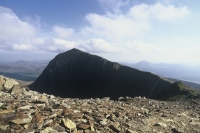
Snowdon
Within the Snowdonia National Park there are nine mountain ranges, covering about 52% of the land. Snowdonia has more than ninety summits that rise above 2,000 feet, and fifteen over 3,000 feet.
Of all the mountains in Snowdonia, the most famous is of course Snowdon (in Welsh, “Yr Wyddfa” – the tomb), which at 3,560ft is the highest peak in England and Wales. Every year over 350,000 visitors reach Snowdon’s summit, either on the Snowdon Railway or by foot.
There are six official footpaths leading up Snowdon to its summit: Llanberis path, Miners path, Pyg track, Watkin Path, Rhyd Ddu path and Snowdon Ranger path.
200 miles
Snowdonia’s coastline stretches for 200 miles, and most of this is designated National Park or Area of Outstanding Natural Beauty.

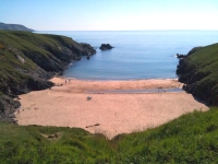
Porth Iago
Snowdonia’s beaches each have their own distinct features and ‘personalities’; if you were to walk the entire length of the Snowdonia coast you’d encounter beaches that are rocky, sandy, pebbly, dotted with rock pools or caves, and often overlooked by cliffs. Some are busy, others are almost completely deserted. Some epitomise the typical British seaside experience, while others are secluded gems that few people know about.
Snowdonia’s ‘seaside’ beaches – those with the most activities and facilities for families – include Barmouth, Tywyn, Llanfairfechan, Pwllheli, Abersoch and Dinas Dinlle.
Many of Snowdonia’s more secluded beaches are on the Llyn Peninsula, which is dotted with wonderful ‘porths’ – beautiful little quiet, sandy coves that are off the beaten track and feel like your own personal discoveries. Porth Iago, Porth Oer, Porth Dinllaen, Porth Colmon, Porth Ysgaden, Porth Ty Mawr and Porth Meudwy are a few examples of these.
To experience all the delights of Snowdonia’s coast, walk along the Wales Coast Path or the Llyn Coastal Path, which will show you just how many types of beach Snowdonia has.
200BC

Bryn Cader Faner
Snowdonia has been inhabited by humans since prehistoric times; many ancient artefacts have been discovered in the region, as well as a number of Roman finds (visit the Gwynedd Museum and Art Gallery in Bangor to see some of these).
Dotted throughout the region there are standing stones and burial chambers aplenty. There are dozens of ancient remains like these in Snowdonia – take your pick! Dolmen Bachwen in Clynnog Fawr, Bryn Cader Faner near Porthmadog, Cors y Gedol near Barmouth… there are far too many to list, but there’s a very comprehensive list at The Modern Antiquarian website, which is worth a read if you’re interested in Snowdonia’s ancient sites.
Snowdonia has several hill forts, too. Perhaps the best known (and one of the best preserved) of these is Tre’r Ceiri on Yr Eifl, the triple-peaked mountain between Trefor and Nefyn. Tre’r Ceiri stands 400ft above the sea and dates back to 200BC. It’s remarkably well preserved, with the remains of 150 stone huts still visible, huge ramparts, and parts of walls that still stand at over 4m high in places.
641
Wales as a whole has 641 castles – more per square mile than in any other country in the world. Many of Wales’ most famous castles are in Snowdonia, along with some that aren’t so well known.

Criccieth Castle
Perhaps the best known castles in Snowdonia are those that are protected by UNESCO World Heritage status – Caernarfon, Harlech and Conwy – while the lesser-known (but no less interesting or important) castles include Criccieth, Dolbadarn, Dolwyddelan and Castell y Bere.
And that’s just the really old castles; Snowdonia also has a number of 18th and 19th century castles and castellated mansions, like Penrhyn Castle, Bryn Bras and Castell Deudraeth.
Mountains, beaches, castles, Iron Age hill forts… when you visit Snowdonia, there’s enough to keep you occupied 24 hours a day, 365 days of the year… it’s all about the numbers!
Wanted to put in a word for Dolbadarn castle, just outside Llanberis. The interesting fact here is that it’s one of the few castles in the area built by the Welsh to defend themselves rather than by the English to attack the Welsh. Beautiful situation on a raised bit of ground between the two lakes.